

US Navy
![]()
Marine Species Monitoring
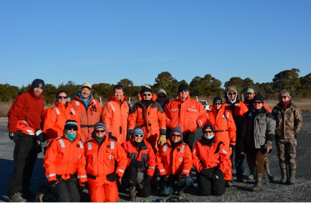
Seal Tagging Team Win!
After many months of planning and preparation, it all came together Super Bowl Sunday for the Seal Tagging and Tracking project! The highly dedicated and experienced team, working under US Fleet Forces Command support, successfully tagged 4 harbor seals in Virginia waters.
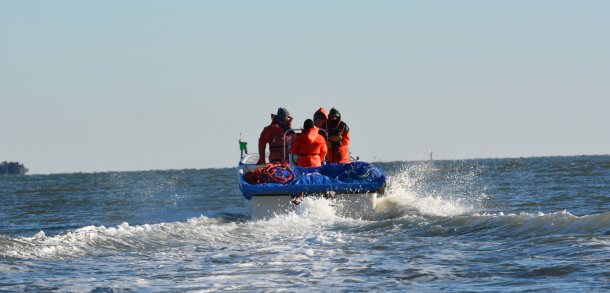
 Capture team led by Rob DiGiovianni, Atlantic Marine Conservation Society. Photo credit - Deanna Rees, NAVFAC Atlantic
Team members from Naval Facilities Engineering Command Atlantic, Naval Undersea Warfare Center Division Newport, the Atlantic Marine Conservation Society, Virginia Aquarium, HDR, Inc., The Nature Conservancy, Virginia Department of Game and Inland Fisheries, and the National Marine Fisheries Service spent months planning and problem solving to finally have success satellite tagging seals in Virginia. The Navy has been interested in tagging harbor seals because our current understanding of their habitat use in the mid-Atlantic is limited. Navy training and testing activities occur in areas that likely overlap with harbor seals in this region, therefore, it’s important to assess any potential impacts these activities may have.
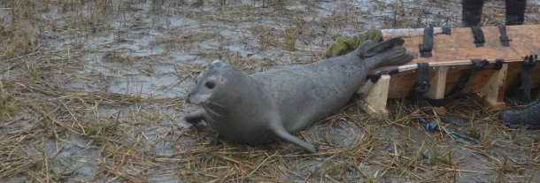
 The satellite telemetry tags used during this study will transmit data on the location of the seal until it falls off during the summer molt. NMFS-NEFSC Permit No. 17670-04. Photo credit - Deanna Rees, NAVFAC Atlantic
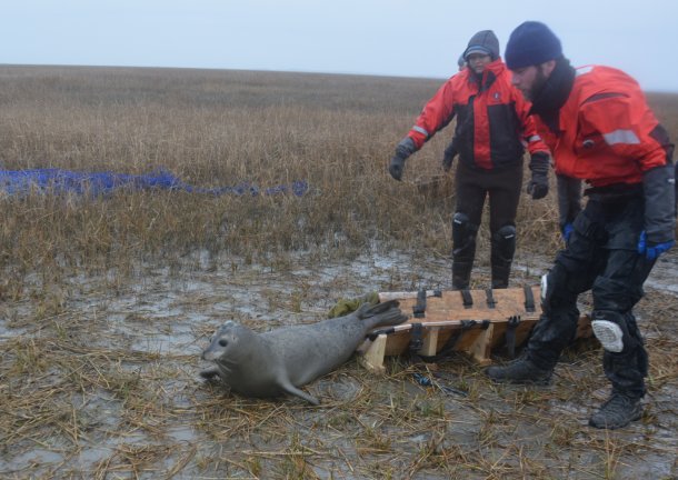
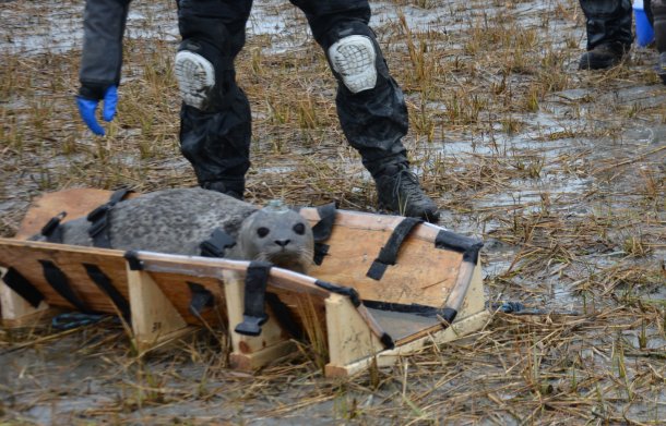 The restraint board was specifically designed by Phil Thorson and Monica DeAngelis for this project, which helps to reduce stress on both animal and handlers. NMFS-NEFSC Permit No. 17670-04. Photo credit - Deanna Rees, NAVFAC Atlantic
The combination of the satellite telemetry data and acoustic transmitter data will yield a robust data set, providing greater insight into harbor seal use of the area. The satellite telemetry tags track and transmit the location, dive behavior, and environmental data which will be used for habitat and home range modeling, and to create maps of the seals’ movements and potentially undocumented haul-out locations. The acoustic transmitter tags rely on an array of underwater receivers already in place (see project profiles for sea turtle and seal tagging projects) to record the date and time when animals pass near the receiver, generally at a range up to 1km. The primary benefit of the acoustic transmitter data will be the ability to evaluate residency time and seasonality and they have the potential to transmit much longer than the satellite tags. The combination of the two tag types is sure to provide some unique and exciting results.
Stay tuned for more updates!
 Seal is released and heads straight for the water. Everyone is relieved the hard work is done! NMFS-NEFSC Permit No. 17670-04. Photo credit - Deanna Rees, NAVFAC Atlantic
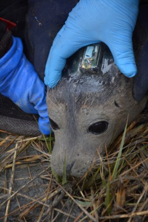
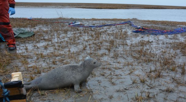 This seal is ready to transmit! All four animals tagged today were transmitting locations. NMFS-NEFSC Permit No. 17670-04. Photo credit - Deanna Rees, NAVFAC Atlantic
 Between Rob’s ideas and the ingenuity of Marcus, Zak and Alex at The Nature Conservancy, a net deployment platform was developed. The design worked well and the net came off without a hitch! Photo credit - Deanna Rees, NAVFAC Atlantic

